
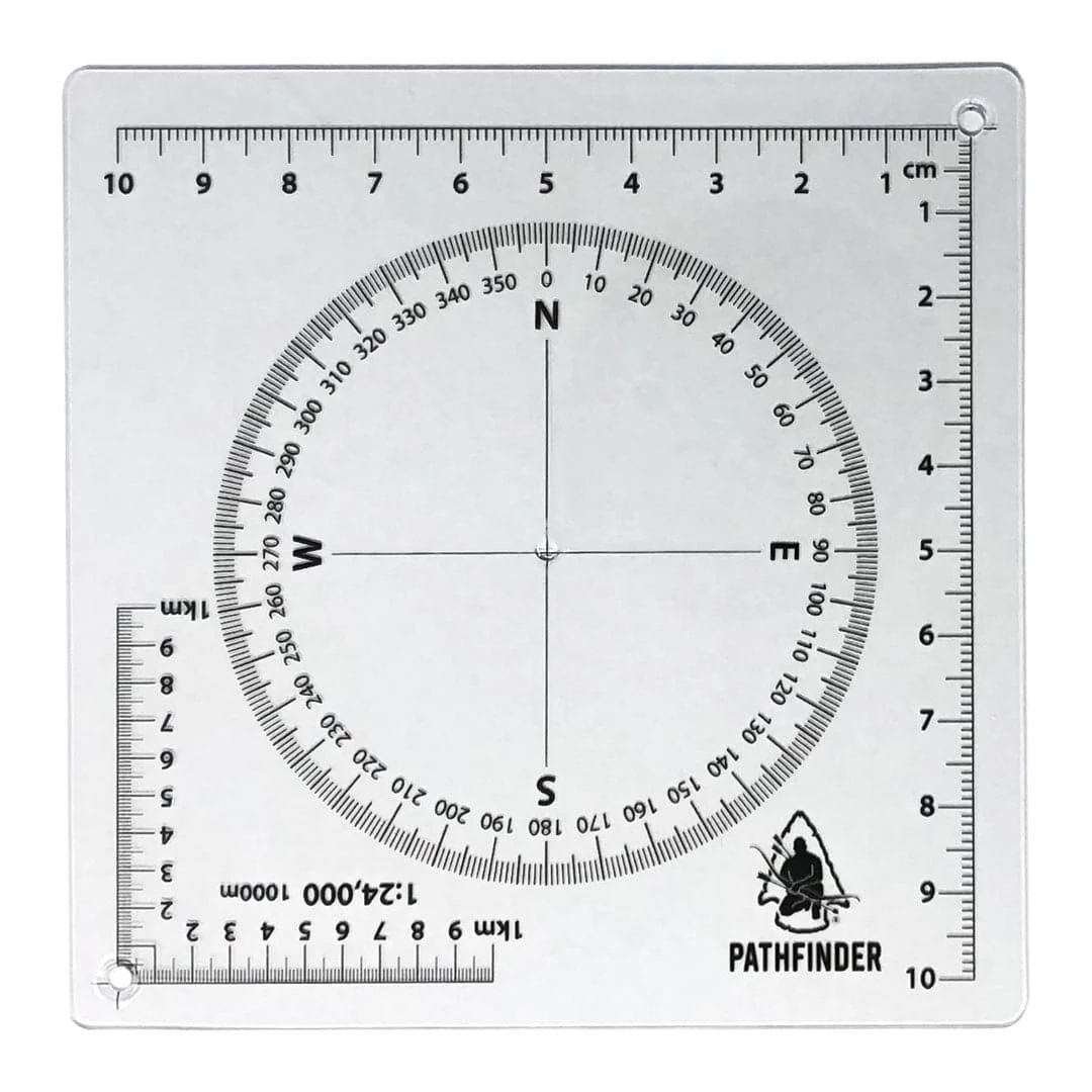
This tool allows you to plot grid coordinates on two different scales of maps. Also included a compass rosette for plotting routes through specific azimuth. This is the exclusive tool used to teach map reading at The Pathfinder School.
Scales:
- 1:24,000
- 1:10,000

![Fontana and Hiwassee Lakes Map [Nantahala National Forest]](https://www.bestoutdoorcollection.com/wp-content/uploads/2026/06/fontana-hiwassee-lakes-map-nantahala-national-forest.webp)